


On Tuesday March 20, 2012, Cat inn Around transited the Intracoastal Waterway from North Biscayne Bay (Mile Marker 1,084) to Tavenier Key (Mile Marker 1,155).
C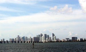 at Inn Around pulled anchor at 9:55 am to clear Bay Harbor’s Broad Causeway for the scheduled 10:15 am opening. Waiting a few minutes, the bridge opened on schedule and we passed through. North Biscayne Bay is beautiful; crystal clear waters offer a rainbow of blues in the bright morning sun. The temperature is about 85º and the there is just a light breeze. Progressing south we see the skyscrapers of downtown Miami growing on the horizon. North Biscayne Bay opens-up and becomes a wider body of water and the ‘no wake zone’ is gone. We push the twin Yanmars to 3,300-RPM and are cruising at about 18½-knots.
With only a 12-foot clearance, we are pushing to make the 10:30 am scheduled opening of the Venetian Causeway at Mile Marker 1088.6. At Mile Marker 1084.6 we approach the 79th Street Causeway. The clearance maker reads 26-feet and we slide under the causeway. Next is the Julia Tuttle Causeway with a 56-foot vertical clearance. We arrive at the Venetian Causeway a little a head of schedule and wait just outside the channel. The current is strong and it takes a bit of maneuvering to maintain our position. A Northbound Yacht has already requested an opening. Behind us a southbound emergency vessel hails the causeway attendant and she immediately starts the bridge opening procedures. We follow the emergency vessel through the opening and maintain a speed of 7-knots. 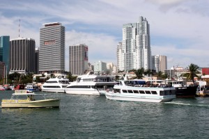 A slight turn to starboard and we align with the channel of the 65-foot MacArthur Causeway that runs along the northern shore of the ‘Government Cut – Port of Miami’. This is the inlet to the Atlantic Ocean used by the massive cruise ships, sitting at berth busily loading passengers. We are now ‘in’ Miami and the skyscrapers seem to rise directly from the edge of the waterway. There are many boats in the busy harbor. We pass the Miami River, which Cat Inn Around transited in 2006 for her ‘inspection survey haul-out’ at the Merrill Stephens
 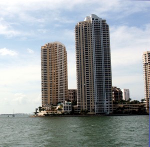 Boatyard. We pass the two iconic skyscrapers on the south bank of the Miami River, prominent in every show/movie filmed in Miami. Soon the regulatory signs says ‘resume normal safe operating speeds’ and we power-up to about 18.5-knots.
Biscayne Bay is wider now as we approach the 76-foot Rickenbacker Causeway at Mile Marker 1,091.6. Clearing the bridge, Biscayne Bay gets much wider, the eastern shore is hardly visible. The western shore slowly gives way to the famous ‘stilt home’ community on the shallow bay known as ‘Stiltville’. Only seven stilt homes remain, now property of the National Park Service. With nothing to stop the wind, there is a 3-foot chop hitting our port hull almost broadside. Pressing-on, the spray from the chop makes it to the bridge and we trim our speed to about 16-knots. Checking below, there is spray and water everywhere on the aft-cockpit. At 28-miles Biscayne Bay is a long body of water; we settle-in for a couple of hours of choppy conditions. The Day-markers are widely spaced; it would hard to imagine navigating the ICW 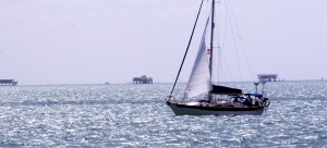 without a GPS. The Day-markers are invisible on the horizon; the Day-marker location on the GPS screen and the green ‘heading line’ are the only way to be certain we are in the ICW channel. The waters are about 10-foot deep so there is little fear of running aground, but staying on course is a priority. We proceed on a course of 194º-true for about 16-miles. At Mile Marker 1,108 four Day-markers define the narrow channel through Featherbed Bank. The water’s brown ‘sea-grass’ color shows that there is no water on either side of the channel. We press-on at about 17-knots. The GPS identifies the next ‘invisible’ marker off on the horizon. We proceed ahead for about 7-miles on a course of 187º-true. After clearing red Day-marker “8” we shift course to 216º-true and continue on at 18-knots. At Mile Marker 1,118 a series of Day-markers guide us through the narrow channel of Cutter Bank. We slow to 7-knots and leave Biscayne Bay behind. Clearing Day-marker Green ’15’ we enter Card Sound and alter our course to 228º-true. Again the markers for the next small channel are too far away to see, the GPS points us on a heading of 184º-true. The water depth is a uniform 5-foot below our keel, and with the waves now on our stern, 3,300 RPM propels us at about 19½-knots. In the distance is a tall bridge and the GPS seems to point to the west end of the bridge. At about 2:00 pm a series of red and green day-markers define a narrow channel. There is sea grass visible just below the surface on both sides. We slow to 7-knots and clear the channel. We are now at the entrance to the Card Sound Bridge at Mile Marker 1,126.9 with a 65-foot vertical clearance. We hail a northbound sailboat on the VHF and ask them to come through first as we wait just outside of the channel. Clearing the bridge again starts the ‘GPS only’ navigation through Barnes Sound on a course of 191º. Barnes Sound is only 4.75-miles long. At the end we clear Green Marker “29” and the Red Marker “30” and enter Jewfish Creek at Mile Marker 1,133.
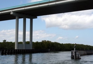
At the end of the creek, we pass under an iconic bridge that marks US-1 entrance onto Key Largo. “We are in keys now!” Now we enter Blackwater Sound, part of the Everglades National Park which protects most of the keys as a ‘particularly sensitive area.’ Marker Red “40” lies dead ahead. The depth gauge shows only 1.9-feet below our keel. Looking behind, two long rows of churned-up sand confirm the depth sounder’s scary readout. We proceed at 7-knots, hoping we can recover from a slow ‘beaching’ vs. running aground at full speed. The beauty of the keys is unsurpassed. Seeing so many islands conjures a line from Lee Shore, Crosby, Stills, Nash and Young: “From here to Venezuela, There’s nothing more to see, Than a hundred thousand islands, flung like jewels upon the sea…’ After passing Red “40”, we enter Dusenbury Creek which connects Blackwater Basin to Tarpon Basin. 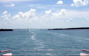 A short run in Tarpon Basin leads to Grouper Creek which spills out into Buttonwood Sound. At Mile Marker 1,144, the southern end of the sound leads to Baker Cut, a small channel between two mangrove islands off the southern shore of Key Largo. A long straight run past Marker Green “61” takes us past Pigeon Key where the channel turns southeasterly toward Tavenier Key. The channel turns again with Day-markers “65” through “69” guiding us through Ramshorn Cut. On our port we pass the Day-makers for Tavenier Creek which we have traversed many times before, but never in Cat Inn Around. The next series of Day-markers “73” through “76” guides us through Cowpens Cut, a narrow channel through the the islands known as Cross Bank. It is now almost 4:00 pm and we are tired of the 7-knot grind and the constant fixation on staying on the ICW’s
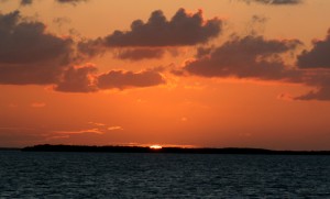 ‘magenta line’ in these shallow waters. The chart shows 7-foot water well outside of the channel. We head out to the deeper water tucked-in behind the islands of Cross Bank. At 4:04 pm we set a secure anchor, easily visible in the pristine, shallow waters. Today we traveled about 70 nautical miles and surly have ended-up in paradise. We settled-in for a glass of wine, a nice dinner and watch a fabulous sunset over a small mangrove island on the horizon.
.